Some of my favorite Saturdays start with coffee, a parking spot near Lovers Point, and absolutely no plan beyond walking the Monterey Bay Coastal Recreation Trail until my legs tell me to turn around. I’m a Bay Area native, and I’ve spent more than 23 years helping families buy and sell homes from Silicon Valley down through Monterey County. I’ve walked, biked, and wandered this trail more times than I can count, in fog, in sunshine, and in that golden hour light that makes everybody on the path stop and pull out their phones. Every photo in this guide is mine, taken over a bunch of different visits, so you’re seeing the trail the way it really looks on an ordinary day.
The Rec Trail, as the locals call it, is one of those rare places that works for just about everybody. It’s paved, mostly flat, and right on the water, so it’s just as good for a grandparent with a cane as it is for a teenager on a rented e-bike. Here’s everything you need to know to plan a great day on it, from the best stretches and where to park to the rules, the wildlife, and my tips for walking it with grandkids or aging parents.
Key Takeaways
Summary: The Monterey Bay Coastal Recreation Trail is an 18-mile paved, mostly flat path that hugs Monterey Bay from Pacific Grove to Castroville, built on an old railroad line from the cannery days. The best-known stretch runs from Fisherman’s Wharf past Cannery Row and the Monterey Bay Aquarium to Lovers Point in Pacific Grove, with sea otters, harbor seals, tide pools, and sweeping bay views along the way. It’s free, open daily, and easy for walkers, cyclists, families, and older adults. Park near Lovers Point or in a downtown Monterey garage, follow the posted rules for bikes, e-bikes, and dogs, and plan on fog even when it’s sunny in San Jose.
Table of Contents
- The Monterey Bay Coastal Recreation Trail at a Glance
- From Sardine Railroad to Rec Trail
- The Trail, Section by Section
- Pacific Grove: My Favorite Stretch
- Wildlife You’ll See Along the Way
- Biking, E-Bikes, Dogs, and Trail Rules
- Parking, Restrooms, and Getting There from Silicon Valley
- Walking the Trail with Older Adults and Grandkids
- The Best Time to Go
- Living Near the Trail
- Frequently Asked Questions
The Monterey Bay Coastal Recreation Trail at a Glance
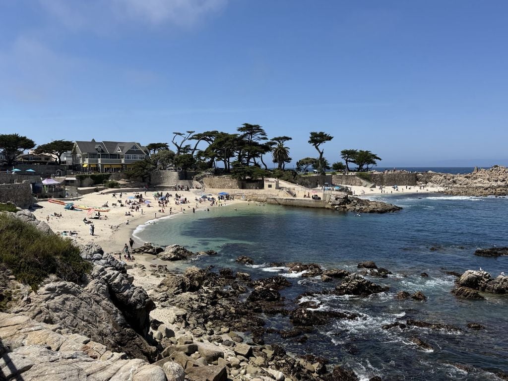
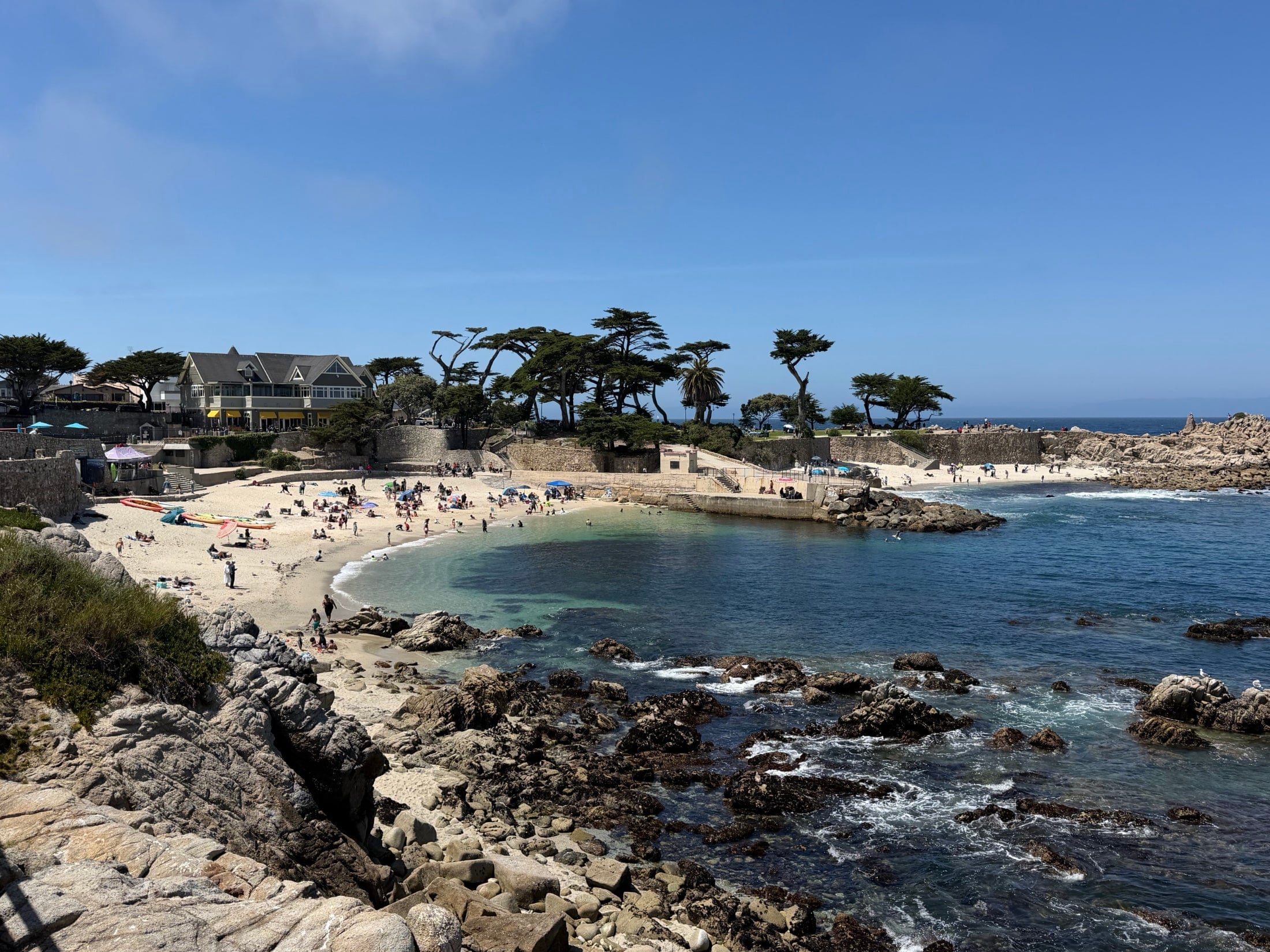
Lovers Point on a warm summer weekend. This little beach is where a lot of people start (or finish) their walk on the Rec Trail.
- Length: About 18 miles, from Pacific Grove to Castroville
- Surface: Paved asphalt, with separate walking and biking paths along the Pacific Grove waterfront
- Difficulty: Easy. It’s mostly flat, with a few gentle grades, more of them on the northern end
- Cost: Free
- Hours: Open daily. Monterey’s city parks and beaches are closed from 10 p.m. to 6 a.m.
- Cities along the way: Pacific Grove, Monterey, Seaside, Sand City, Marina, and Castroville
- Allowed uses: Walking, running, biking, e-bikes, skating, and leashed dogs, with a few local exceptions covered below
- Distance from San Jose: About 70 miles, or roughly an hour and 15 minutes without traffic
From Sardine Railroad to Rec Trail
If you’ve ever wondered why the Rec Trail is so flat and so perfectly placed along the water, thank the railroad. For decades, the Southern Pacific ran a line along this shoreline that connected Castroville to Monterey’s Fisherman’s Wharf and Cannery Row, hauling freight for the sardine canneries John Steinbeck made famous. Before the cannery boom, the same line carried tourists down to Pacific Grove and the old Del Monte Hotel, back when a trip to “the Peninsula” was the fanciest getaway in California.
When the sardines disappeared and the trains stopped running, the Monterey Peninsula Regional Park District proposed turning the abandoned tracks into a public trail. With help from the California Coastal Conservancy and the cities of Monterey, Pacific Grove, and Seaside, the trail started taking shape in the mid-1980s, and it’s been growing and improving ever since. Today it’s part of the larger California Coastal Trail network that’s slowly connecting the whole state’s coastline.
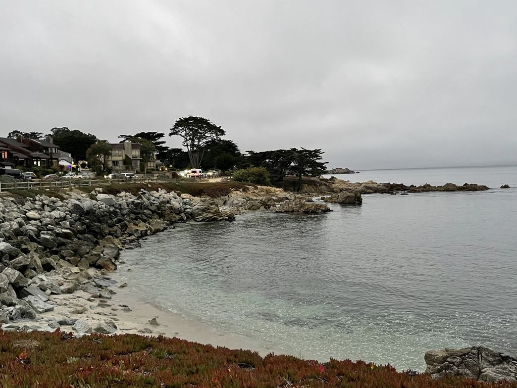
A classic gray Monterey morning on the Pacific Grove shoreline. The fog doesn’t make it any less pretty.
The Trail, Section by Section
Almost nobody does all 18 miles in one shot, unless they’re on a bike. Most people pick a stretch, walk it out and back, and grab lunch somewhere in the middle. Here’s how I think about the trail, from south to north.
Pacific Grove: Lovers Point to the Aquarium
The southern end is the prettiest part of the whole trail, in my not-so-humble opinion. The Pacific Grove section runs about a mile along Ocean View Boulevard, from Pacific Grove’s Lovers Point to the edge of the Monterey Bay Aquarium, with separate paths for walkers and cyclists. You’ll pass rocky coves, little sandy beaches, benches facing the water, and Stanford’s Hopkins Marine Station, one of the oldest marine labs on the West Coast. I’ll go deeper on Pacific Grove in a minute, because it deserves its own section.
Cannery Row and the Monterey Bay Aquarium
Once you cross into the City of Monterey, the trail runs a block above Cannery Row, past the Monterey Bay Aquarium and the old cannery buildings that are now hotels, restaurants, and tasting rooms. It’s the busiest part of the trail, so expect surreys, strollers, and lots of folks stopping suddenly for pictures.
Fisherman’s Wharf and Downtown Monterey
Keep going and you’ll pass the Coast Guard Pier, where you’ll almost always hear the sea lions before you see them, and then Old Fisherman’s Wharf and Custom House Plaza, the heart of historic Monterey. There are restaurants, restrooms, and plenty of spots to rest here, so it’s a natural turnaround point if you started at Lovers Point. That round trip is about 6 miles.
Del Monte Beach, Seaside, and Sand City
North of the wharf, the trail runs along Del Monte Avenue past Monterey State Beach and Del Monte Beach, then on into Seaside and Sand City. The views open up into long stretches of sand and dunes, and the crowds thin out, which makes it a great section for a bike ride.
Fort Ord Dunes and Marina
Past Sand City, the trail runs alongside Highway 1 and Fort Ord Dunes State Park, which used to be part of the old Fort Ord Army base. There’s a parking lot at the state park, which makes it a popular starting point for riders, and the trail connects with the park’s own beach trails in a couple of spots. From there, you’ll roll into Marina, home of Marina State Beach and its towering dunes.
North to Castroville
The northernmost miles are the least polished, with more hills, more wind, some sand on the pavement, and a few spots where the route jogs onto road shoulders. Riding all the way to Castroville, the artichoke capital of the world, is doable if you go in with your eyes open.
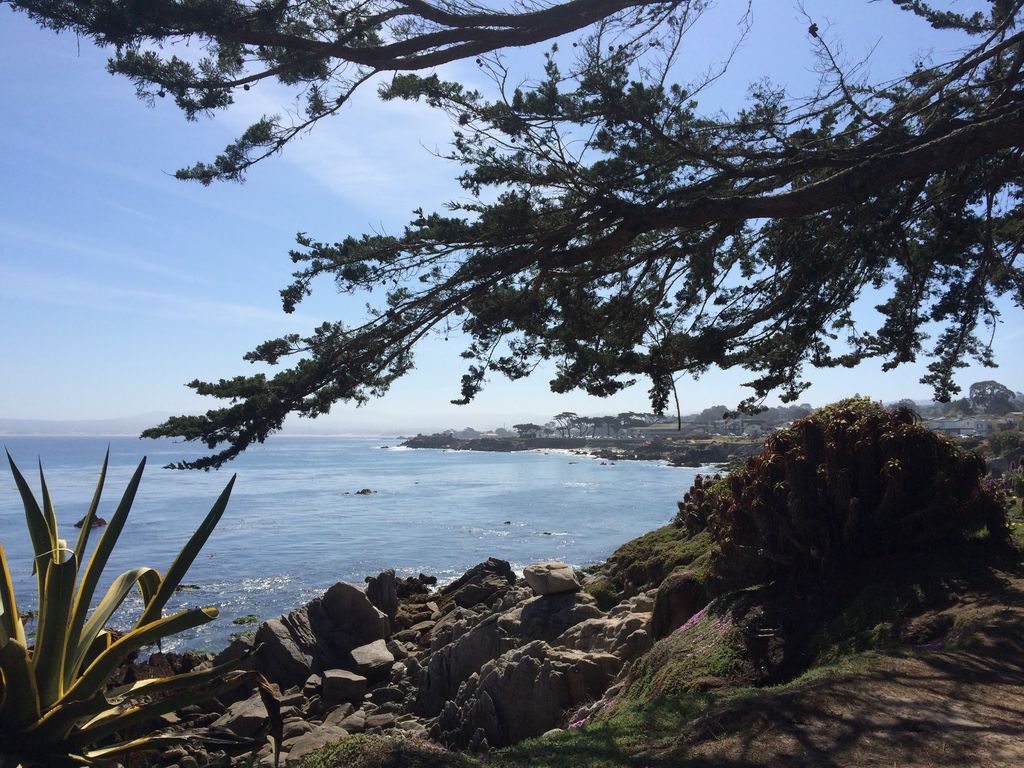
A cypress branch frames the view back toward Lovers Point. This is the kind of spot where you end up sitting longer than you planned.
Pacific Grove: My Favorite Stretch
If you only have time for one part of the Rec Trail, make it Pacific Grove, which is why most of my photos come from this end. The town calls itself “America’s Last Hometown,” and walking its shoreline feels like stepping back a few decades, with Victorian houses on one side of the street and crashing waves on the other.
Lovers Point
Lovers Point is the anchor of the whole Pacific Grove waterfront. There’s a small, protected sandy beach that’s one of the calmest swimming spots on the Peninsula, a grassy park with picnic tables, a snack bar, restrooms, and a big rocky point you can climb out on for views across the bay. Back in the early 1890s, glass-bottom boats launched from a pier here so visitors could peek at the kelp and fish below, and a replica of one of those boats now sits in the park thanks to the Heritage Society of Pacific Grove. You can read more on the historical marker near Ocean View Boulevard and Forest Avenue.
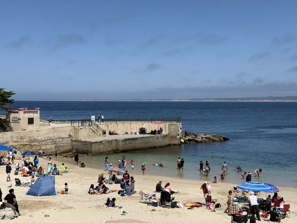
Lovers Point is one of the calmest swimming coves around, which is why you’ll see so many families here on a sunny day.
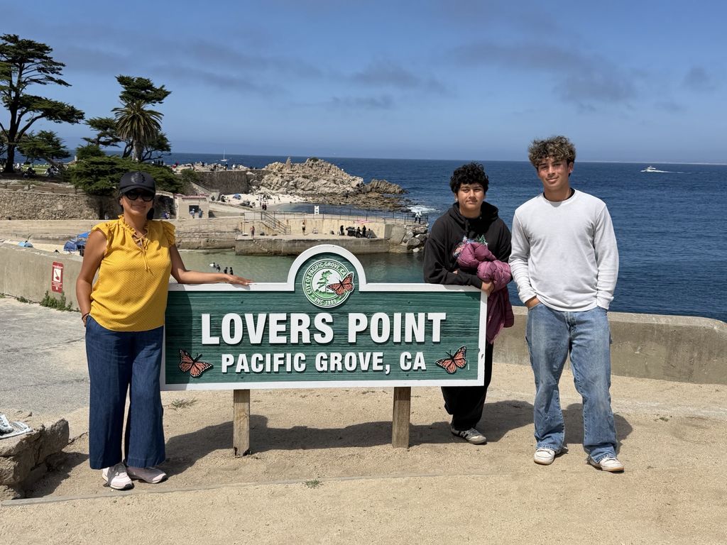
Family day at the Lovers Point sign. You’ll notice the monarch butterflies on it, a nod to Pacific Grove’s nickname, “Butterfly Town, USA.”
The Magic Carpet
Just west of Lovers Point, in Perkins Park, is one of my favorite stories on the entire coast. Back in the late 1930s, a world traveler named Hayes Perkins moved to Pacific Grove and found the bluff covered in poison oak. Instead of just clearing it, he spent roughly 14 years planting a pink-flowering ice plant he’d come across in South Africa, hauling buckets of water by hand to keep it alive. The result is what everybody now calls the “magic carpet,” a mile-long stretch of hot pink and purple blooms that peaks in spring and can keep flowering into summer. KAZU has a great piece on the city’s efforts to keep it going.
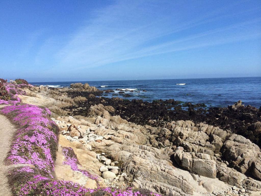
The magic carpet in full bloom. In spring, this stretch is about as pink as the California coast gets.
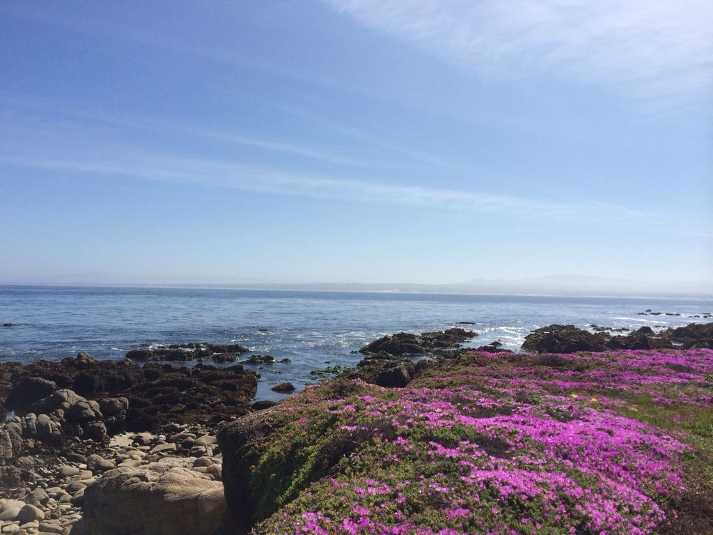
Looking out over Perkins Park, with the bay and the Monterey dunes in the distance.
Continuing On Toward Point Pinos and Asilomar
Technically, the paved Rec Trail ends at Lovers Point, but the walk doesn’t have to. A shoreline path continues west along Ocean View Boulevard toward Point Pinos and Asilomar State Beach. The newer Point Pinos Coastal Trail portion is about five feet wide, with decomposed granite and boardwalk sections, and was designed to provide ADA access to the shoreline.
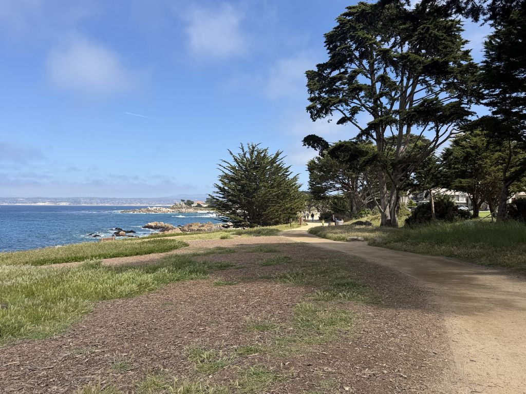
The shoreline path west of Lovers Point is softer underfoot and lined with big old cypress trees.
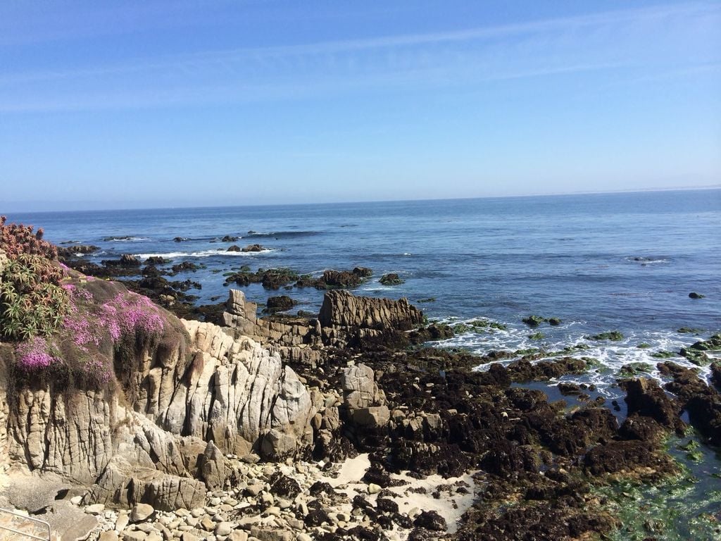
Low tide along the Pacific Grove coast. Look closely and you’ll find anemones, crabs, and the occasional sea star.
Wildlife You’ll See Along the Way
This is the part that keeps me coming back. The entire shoreline here is part of the Monterey Bay National Marine Sanctuary, and a few sections along Pacific Grove and Cannery Row are also protected state marine areas, so the wildlife is everywhere if you slow down and look.
- Sea otters: Look for them floating on their backs in the kelp beds off Pacific Grove and Cannery Row, often cracking open shellfish on their bellies. Binoculars help a lot.
- Harbor seals: They love hauling out on the rocks near Hopkins Marine Station and along the Pacific Grove coves.
- California sea lions: You’ll hear them barking from the Coast Guard Pier and the breakwater near the wharf.
- Whales: Every so often, someone on the trail spots a spout out in the bay, especially during gray whale migration season.
- Monarch butterflies: Not on the trail itself, but the Monarch Grove Sanctuary in Pacific Grove is a short drive away, and the butterflies overwinter there roughly from fall into early spring.
Please give the animals room. Federal law protects marine mammals, so stay well back from otters and seals, especially moms with pups, and never try to feed or touch them.
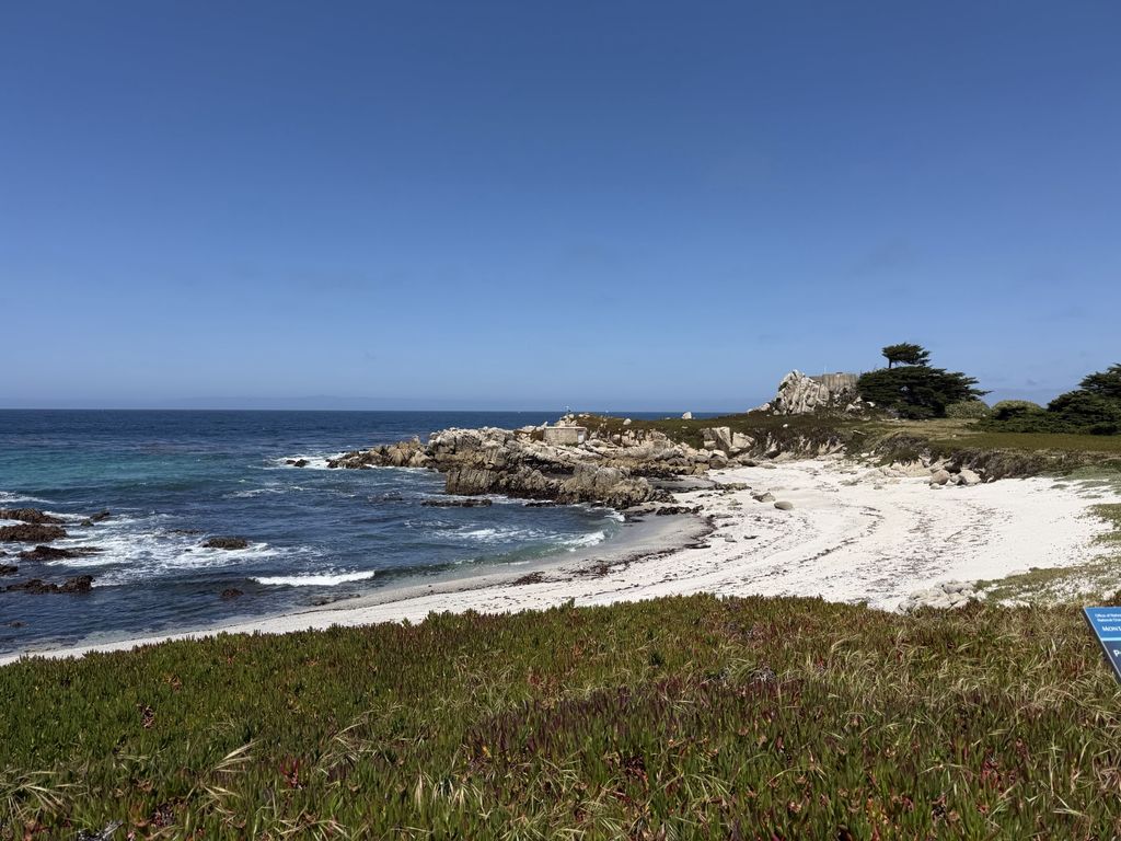
One of the white sand coves along the Pacific Grove shoreline. That blue sign in the corner marks the Monterey Bay National Marine Sanctuary.
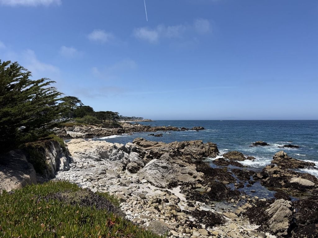
Rocky shoreline and tide pools looking back toward Monterey. These rocks are prime harbor seal territory.
Biking, E-Bikes, Dogs, and Trail Rules
The Rec Trail passes through several cities, and each one makes its own rules, so it pays to watch for posted signs. Here’s what the City of Monterey lists for its part of the trail.
- E-bikes: All three classes of e-bikes are allowed. California’s AB 1909, which took effect January 1, 2024, opened the trail to Class 3 e-bikes. Mopeds, motorized scooters, and other motorized vehicles are not allowed.
- Riding etiquette: Ride single file at a safe speed, stay to the right, and use a bell or call out “passing on your left” before you pass.
- Walkers and runners: No more than two abreast, and look both ways before you step across the path.
- Skateboards: Not allowed between the head of Fisherman’s Wharf and the Pacific Grove city limit.
- Dogs: Welcome on a leash no longer than six feet, and you need to pick up after them.
In Pacific Grove, walkers and cyclists have separate paths, and the city has been taking a closer look at e-bike behavior along the waterfront, so slow down and check the signs there. If you don’t have your own bike, rental shops on Cannery Row and near Fisherman’s Wharf rent regular bikes, e-bikes, and those big four-wheeled surreys that seat the whole family.
Parking, Restrooms, and Getting There from Silicon Valley
From San Jose, take Highway 101 south to Highway 156 west and then Highway 1 south into Monterey. Without traffic, it’s about an hour and 15 minutes.
- Pacific Grove: Street parking along Ocean View Boulevard and near Lovers Point. It fills up fast on sunny weekends, so get there early and read the signs carefully.
- Cannery Row and downtown Monterey: Several public garages and lots, which is the easiest option if you plan to visit the aquarium or eat on Cannery Row.
- Fisherman’s Wharf: Paid lots right next to the wharf and the trail.
- Fort Ord Dunes State Park: A parking lot with easy trail access, popular with cyclists heading north or south.
- Restrooms: You’ll find them at Lovers Point, around Fisherman’s Wharf, and at several beach parks along the route.
- Transit: Monterey-Salinas Transit buses have bike racks, so you can ride one way and bus back.
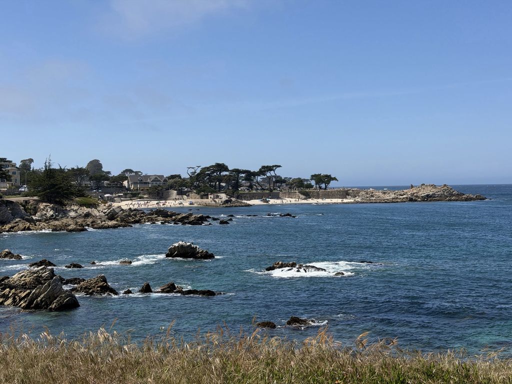
Lovers Point from across the cove. If you can find parking near here, it’s the perfect home base.
Walking the Trail with Older Adults and Grandkids
A lot of the families I work with are juggling three generations at once, and the Rec Trail is one of my go-to suggestions for a day out that works for everybody. Since I hold the SRES, CSA, and CAPS designations and spend most of my time helping older adults and their families, I tend to look at places like this through a “will Mom be comfortable here?” lens. Here’s what I’d tell a friend.
- Start short. Lovers Point to the aquarium and back is about 2 miles round trip, flat, and full of benches. That’s plenty for a lot of folks.
- Use the benches. Pacific Grove has benches facing the water every few hundred feet, which makes it easy to take breaks.
- Pick wheels-friendly sections. The paved trail works well for walkers, wheelchairs, and strollers. The Point Pinos path west of Lovers Point was built with ADA access in mind, but some older side trails are dirt and uneven.
- Watch for bikes. Stick to the pedestrian lane where there is one, and keep little ones close, because e-bikes can come up faster than you’d expect.
- Layer up. Monterey fog is real. It can be 85 in San Jose and 60 and breezy on the trail.
If you’re looking for more outings like this, I keep a running list of things to do for seniors in the South Bay, and the Los Gatos Creek Trail is a great, flat option closer to home.
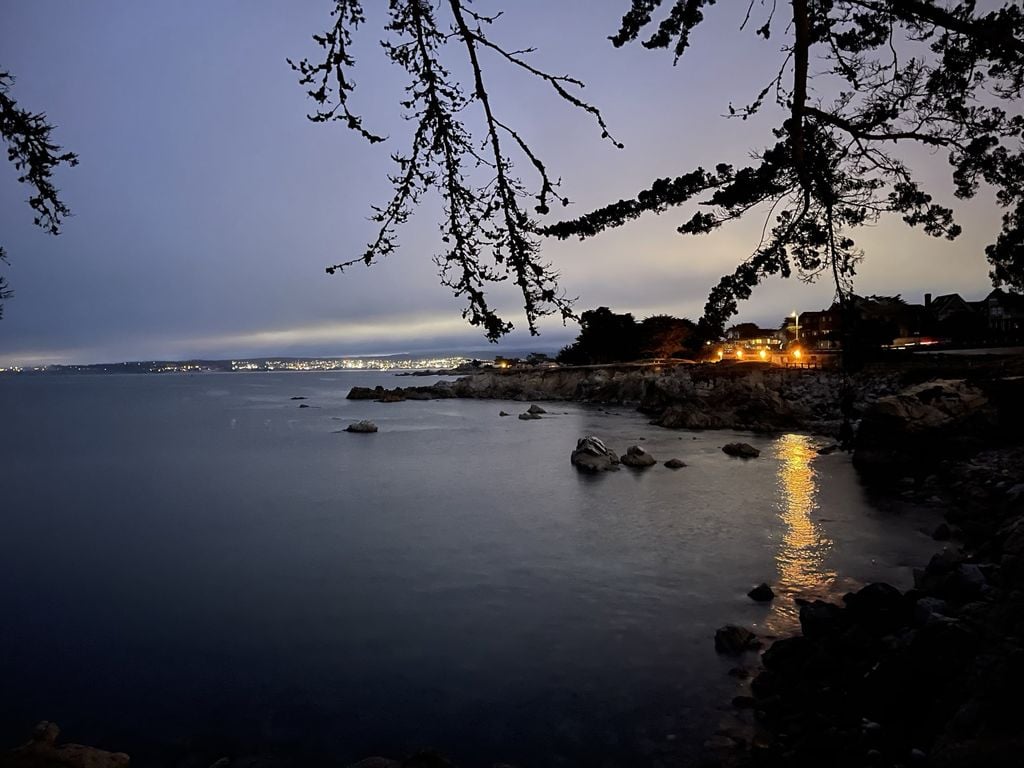
Dusk on the Pacific Grove shoreline, with the lights of Monterey and Seaside coming on across the bay.
The Best Time to Go
There’s really no bad time to go, but each season has its own personality.
- Spring (April and May): The magic carpet is blooming in Pacific Grove, the hills are green, and the crowds haven’t hit yet. This is my favorite.
- Summer: The busiest season, and also the foggiest. Mornings are often gray, and afternoons can clear up beautifully.
- Fall (September and October): The locals’ secret. The fog usually backs off, the water looks its bluest, and the summer crowds are gone.
- Winter: Quiet, crisp, and dramatic, with big surf on stormy days and the monarchs overwintering nearby.
Early mornings are calm, sunset at Lovers Point is something everybody should see at least once, and on weekends you’ll want to be on the trail before 10 a.m. for parking and elbow room.
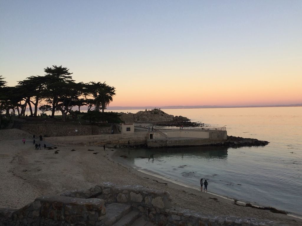
Sunset at Lovers Point. Stick around after the sun goes down, because the sky keeps getting better.
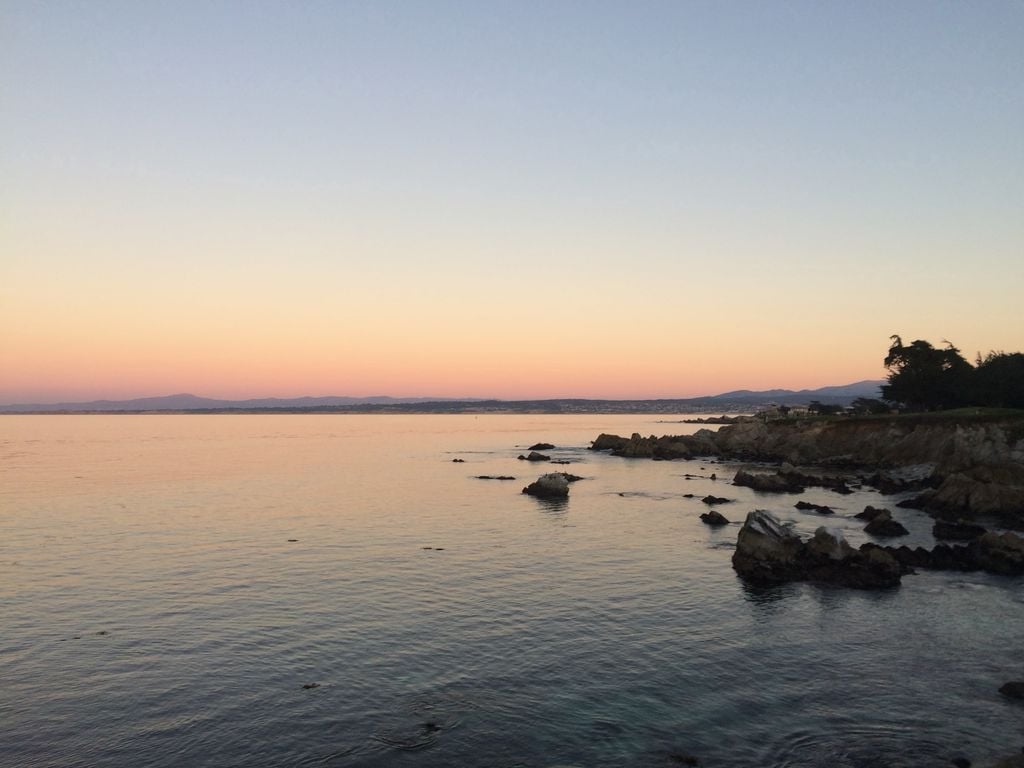
Looking northeast across the bay at sunset. On a clear evening you can see all the way to the Santa Cruz Mountains.
Living Near the Trail
I get asked about this a lot, especially by Silicon Valley homeowners thinking about their next chapter. Being able to walk out your door and onto a paved, flat, waterfront trail is a big deal, especially as we get older and staying active and connected matters more than ever. Walkable neighborhoods tend to hold their appeal with buyers, too, which I wrote about in my piece on walkability and Walk Score.
Each town along the trail has its own feel. Pacific Grove is small and walkable, full of older homes and cottages near the water, Monterey offers more restaurants, culture, and services, and Seaside and Marina often give you more home for the money with the dunes minutes away. If you’re also looking at Carmel-by-the-Sea, my Carmel Village guide is a good place to start, and my list of the best small towns to retire to from Silicon Valley has a few more ideas.
If you’re thinking about cashing out of a longtime Silicon Valley home and moving closer to the water, or helping a parent do it, I’d love to help you think through it. I’m a broker associate with Compass, and I know agents all over the Monterey Peninsula I trust. Give me a call at 408-413-3087, and I’ll help you make your next move the best one yet.
Frequently Asked Questions About the Monterey Bay Coastal Recreation Trail
How long is the Monterey Bay Coastal Recreation Trail?
Where does the Monterey Bay Coastal Recreation Trail start and end?
What is the best section of the Monterey Bay Coastal Recreation Trail to walk?
Is the Monterey Bay Coastal Recreation Trail paved and flat?
Are e-bikes allowed on the Monterey Bay Coastal Recreation Trail?
Are dogs allowed on the Monterey Bay Coastal Recreation Trail?
Where can I park to walk the Monterey Bay Coastal Recreation Trail?
Is the Monterey Bay Coastal Recreation Trail good for seniors and people with limited mobility?
When does the magic carpet bloom in Pacific Grove?
Can you see sea otters from the Monterey Bay Coastal Recreation Trail?
Private Access
See the Bay Area Homes That Never Hit Zillow
A lot of the best homes in Silicon Valley and the Bay Area change hands quietly, before they're ever listed. Get free access to our off-market homes database and see what's available right now.
You're in. Thanks! Taking you to the off-market homes database now.
Delightful Homes For Sale in Monterey
2
3
4
5
6
7
8
9
10
11
12
13
14
15
16
17
18
19
20
21
22
23
24
25